Blog
RF Coverage Study for Outdoor Area
An outdoor coverage study is a critical component in engineering design, particularly in the planning and deployment of wireless communication systems, such as cellular networks, Wi-Fi, and IoT infrastructures. This study evaluates the spatial reach and signal strength of a network in outdoor environments, considering variables such as terrain, vegetation, buildings, and weather conditions.
Using simulation tools and field measurements, engineers assess signal propagation, identify coverage gaps, and optimize antenna placement, height, and orientation. The insights from this study directly influence network performance, reliability, and user experience. Moreover, the outdoor coverage study plays a vital role in ensuring regulatory compliance and efficient spectrum utilization, making it a foundational element in the design and implementation of modern wireless systems.
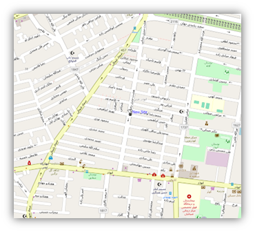
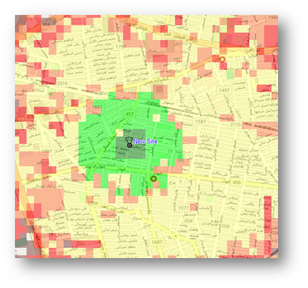
In Rama Fiber Kish we use Radio Planner software to do the coverage study for outdoor area.
What is Radio Planner Software?
Radio planner software is a specialized engineering tool used to design, simulate, and optimize wireless communication networks. It helps network engineers plan where to place antennas and base stations, how to configure them, and how to predict how signals will travel through the real-world environment (like cities, mountains, or open areas).

Key Functions:
- Coverage Prediction:
The software uses terrain data, building maps, and signal propagation models to simulate how far and how well signals will reach. This helps ensure users get strong, reliable coverage. - Capacity Planning:
It estimates how many users will be on the network and helps ensure the infrastructure can handle the expected traffic without slowing down or dropping connections. - Frequency Management:
It prevents interference by planning how radio frequencies are reused across different parts of the network. - Network Simulation:
Engineers can run simulations to see how the network will perform before anything is built — saving time and money. - Post-Deployment Optimization:
Once a network is live, the software helps monitor performance and fine-tune parameters like antenna tilt, power levels, or handover settings. - Regulatory Compliance:
It ensures the network setup follows national and international rules about frequency use and signal power.
In the context of broadcast planning, the software evaluates field strength at the receiver location, identifies the optimal transmitter (best server), and models simulcast delay spread, which is critical for digital broadcasting systems. It also supports the generation of regulatory coverage contours—such as those defined by the FCC or ITU-R—enables estimation of covered population, and can produce lists of specific localities within the broadcast footprint.
Other Features:
Advanced features enhance the analytical depth of the planning process. These include multi-network project management, aggregate coverage visualization, and frequency planning capabilities that account for both co-channel and adjacent-channel interference. Path profile analysis tools offer detailed visualization of terrain and obstructions along signal paths, while multipoint studies can be conducted for fixed wireless or IoT applications using location-specific parameters. The software also supports validation through comparison of simulated and measured signal levels, allowing for model tuning and calibration.
Integrated GIS Capabilities:
To support integration with other systems and workflows, planning results can be exported in various formats such as KMZ (for GIS mapping), PNG, GeoTIFF, CSV, and MIF. Custom map layers and user-defined vector data further enhance flexibility in visualization and reporting. Overall, radio planning software serves as a comprehensive toolset for network design, performance analysis, and optimization across a wide spectrum of wireless communication applications.